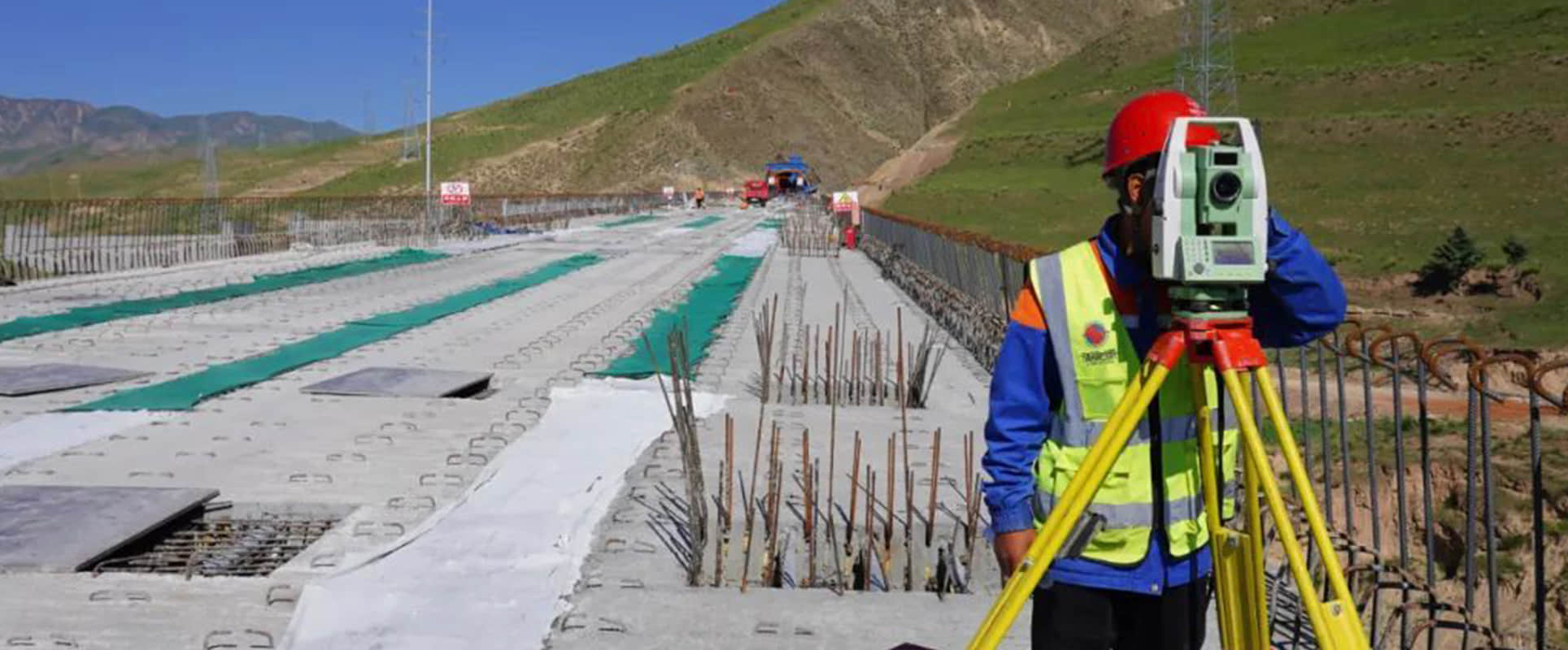
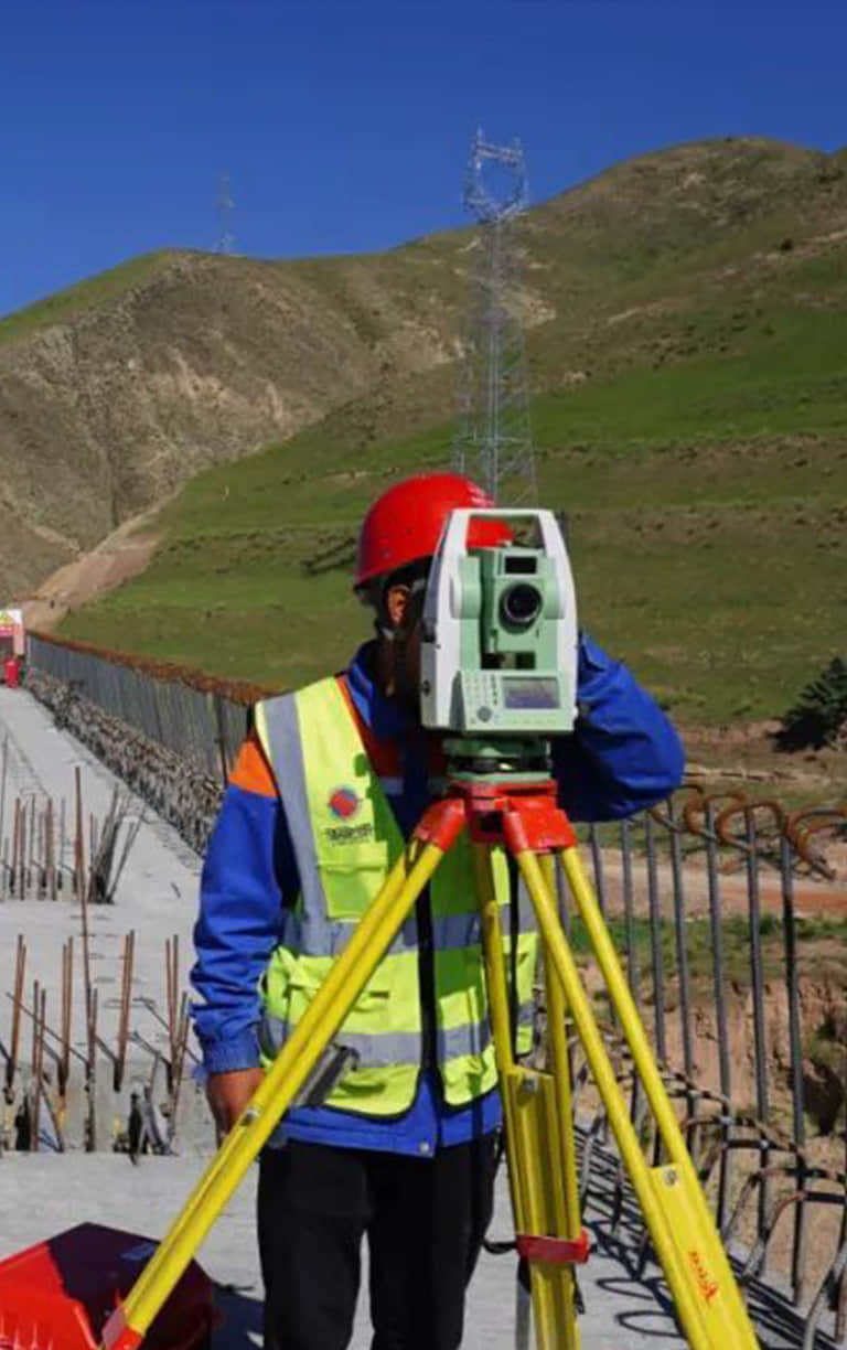
全站仪Total Station
- 我们的全站仪采用尖端技术,确保在各种环境下都能进行精准的角度和距离测量,满足您各项工程需求。- Equipped with cutting-edge technology, our total station ensures accurate angle and distance measurements in various environments, fulfilling all your engineering needs.
- 通过简单的按键或配套软件,您即可快速完成测量设置、数据记录与处理,大幅提升工作效率。
- With simple button presses or the accompanying software, you can quickly complete measurement settings, data recording, and processing, significantly boosting work efficiency.
- 坚固的外壳设计和稳定的电子系统,使全站仪能够抵御恶劣环境,确保长期使用的稳定性与可靠性。- Boasting a sturdy outer shell and a stable electronic system, the total station withstands harsh environments, ensuring long-term stability and reliability.
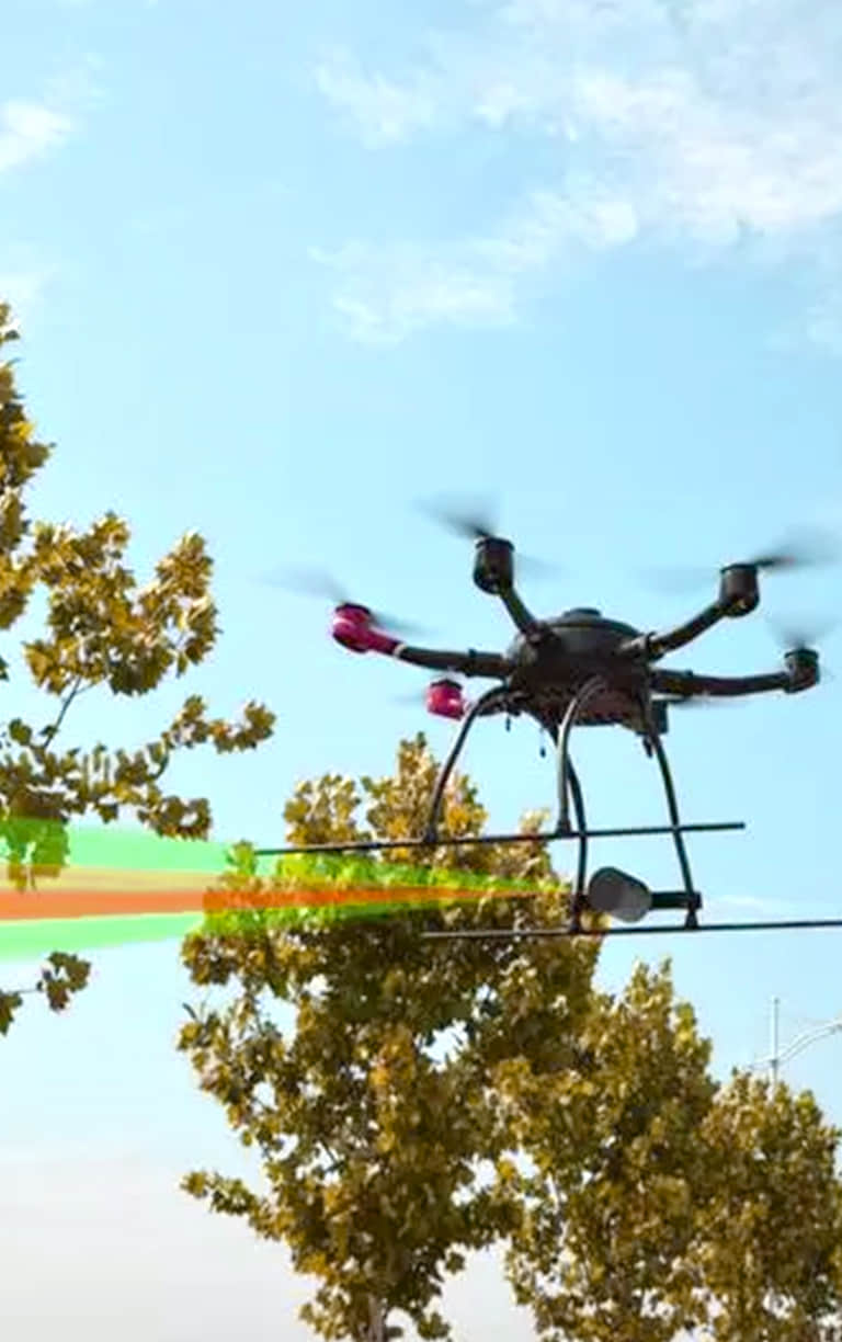
无人机控制drone control
广泛适用航空摄影测量、边防监控、军事侦察和警情消防监控、电力巡线、城市规划、国土调查、矿产开发、应急救灾、森林防火、生态监测、防汛抗旱等行业。
It is widely used in industries such as aerial photogrammetry, border monitoring, military reconnaissance and police fire monitoring, power line patrol, urban planning, land investigation, mineral development, emergency response, forest fire prevention, ecological monitoring, flood control and drought relief.

激光雷达Lidar
使用移动激光雷达系统进行测量,可有效解决传统作业方式效率低下,受地形环境等因素限制较大的情况。
The use of a mobile lidar system for measurement can effectively solve the problem of low efficiency of traditional operation methods and large restrictions by factors such as terrain and environment.
森林防火Forest fire prevention
-(占总业务的50%)-他们购买了FIS的QA芯片,用他们的技术在内部组装
-(Accounting for 50% of the total business)-They bought FIS QA chips and assembled them in-house with their technology
- 用于消防导航,覆盖范围5-10公里-Used for fire navigation, covering a range of 5-10 kilometers

遥感测绘Remote sensing mapping
从地面测量到航空测量,从传统的GNSS测量到3D-Mobil绘图解决方案的海量数据采集,机器控制和农业自动转向。从网络解决方案到先进的桥梁监控系统,所有这些都是在实时基础设施中实现的。
From ground surveys to aerial surveys, from traditional GNSS surveys to the massive data collection of 3D-Mobil mapping solutions, machine control and agricultural automatic steering. From network solutions to advanced bridge monitoring systems, all of these are implemented in real-time infrastructure.


 首页
Home
首页
Home
 关于我们
About
关于我们
About
 产品介绍
Product
产品介绍
Product
 新闻中心
News
新闻中心
News
 人力资源
Join
人力资源
Join
 联系我们
Contact
联系我们
Contact
 English
中文
English
中文